The Arab World Map.
Here you again, another Mocking LifeSystem, but a more extreme one, offensive geographically.
- Have you ever wondered about our huge Arab World map from its far East to its Far West, from Oman to Mauritania?.
- Have you ever planted a thought or a doubt in your mind about its existence and political borders?
- Have you asked yourself How were those borders drawn?
I think most of us did not, in fact, only few did but disappeared...Don't ask me how they disappeared, just ask their governments they might know. When I was a teenager in high school, I used to look at the Arab World Map and smiled, trying to figure out its look, because each country has different shapes, and drawn in straight lines, exactly with rulers and in hurry, I think the imperial nations, England and France, did not have much time to carefully draw the borders, they only cared about Domination, So here's the Arab World Map for you Dear Readers:
 Ref: Wikipedia
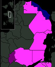
This is the Arab World map for those who are not familiar with it. See how straight the borderlines are, who drew it must use really straight rulers, they might have even split a tribe in the middle of the desert without knowing, or a human being. However, Wait a minute, I think those who drew the map were also sexually aroused, or maybe they wanted to make fun of us, none of them cared about Arabs much anyway, THEY ARE THE IMPERIALISTS, aren't they?, 70% of the Arab world map does in fact look like a woman somehow:
 A Sexy, Sad Woman, Algeria, its breast.
 Ref: CIA - UAE's map
I can go into this into more details, but I will try to be short:
Previous Mocking LifeSystem[9]
I think the British or the French did not know what to do with the Sudanese so they drew Sudan as the biggest country in Africa so Sudanese can have something to be proud of. If you check the Map of UAE, it will remind you of Loch Ness Lake Monster, while Somalia is just one pair of socks. I think the British who was drawing the map, mistakenly dropped a drop of ink onto the map of the Persian or Arabian sea, so then they had to create an island there, and they did and they called it, Bahrain. That Huge Arab World map was drawn carelessly, tribally, traditionally, pleasing sheikhs, and princes, ignoring faith and history, offending me and my faith, achieving imperialist's goals of power and greediness, and unfortunately it was not distributed equally fairly economically in any mean, just a huge land full of sands and in a useless time to serve Imperialism.
Note: What I have written might be offensive to some, but this is only Mocking LifeSystem sending an indirect message plus you should not be offended because you did not make your own country and you did not draw most of your borders.
Previous Mocking LifeSystem[9]
2 comments:
"That Huge Arab World map was drawn carelessly, tribally, traditionally, pleasing sheikhs, and princes, ignoring faith and history, offending me and my faith, achieving imperialist's goals of power and greediness, and unfortunately it was not distributed equally fairly economically in any mean, just a huge land full of sands and in a useless time to serve Imperialism."
*Claps, slowly"
Thanks for stopping by ti3gib. Yes, that's just a part of the next briefword. briefwords on the archive blogs.
Salam.
Post a Comment